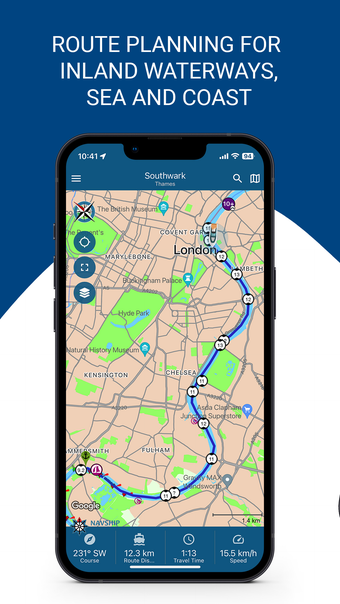
NavShip - Waterway Routing Overview
NavShip is a free iPhone application developed by CproSoft GmbH, designed for travel and navigation enthusiasts. With NavShip, users can effortlessly navigate 400,000 kilometers of waterways spanning Europe and North America. Whether you're cruising inland, at sea, or along the coast, this app ensures you stay on the right course. It caters to various types of boats including motorboats, sailboats, and rowing boats.
The app provides a comprehensive set of features including jetty-to-dock route planning, live weather data, wind conditions, tidal information, clearance heights, details on marinas, anchorages, and berths. NavShip also offers real-time news for inland shipping, slip ramps, AIS integration, water levels, water filling stations, and considers flow speeds when planning trips, issuing warnings if necessary.